
Snowdonia
THE Snowdonia Mountains and Coast area includes the Llŷn Peninsula, Cambrian Coastline, Conwy Valley and Hiraethog.
‘Land of contrasts’ is one of those overused clichés scattered around travel guides with gay abandon. But here, it happens to be true. One minute you’re up, up and away in the mountains. Next stop, you’re on the beach. It’s no exaggeration to say that you can feel on top of the world in the morning (Snowdon’s peak experience), and have Saharan quantities of sand beneath your feet in the afternoon (at Harlech, Dinas Dinlle or Black Rock Sands).
That’s not quite so surprising when you consider that Snowdonia Mountains and Coast embraces the Snowdonia National Park, Llŷn Peninsula (an Area of Outstanding Natural Beauty) and around 200 miles of coastline.
from visitsnowdonia.info
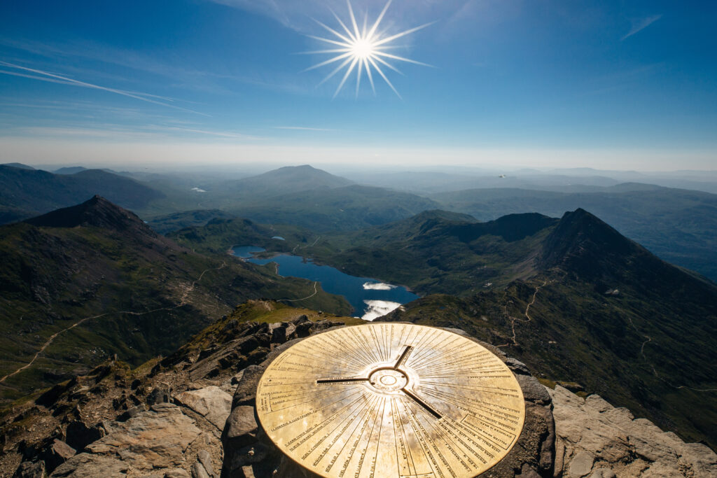
Snowdonia is a mountainous region in northwestern Wales and a national park of 823 square miles in area. It was the first to be designated of the three national parks in Wales, in 1951. It contains the highest peaks in the United Kingdom outside Scotland.
The English name for the area derives from Snowdon, which is the highest mountain in Wales at 3,560ft (1,085m). In Welsh, the area is named Eryri.
In the Middle Ages, the title Prince of Wales and Lord of Snowdonia (Tywysog Cymru ac Arglwydd Eryri) was used by Llywelyn ap Gruffudd; his grandfather Llywelyn Fawr used the title Prince of north Wales and Lord of Snowdonia.
Before the boundaries of the national park were designated, ‘Snowdonia’ was generally used to refer to a smaller area, namely the upland area of northern Gwynedd centred on the Snowdon massif, whereas the national park covers an area more than twice that size extending far to the south. The traditional Snowdonia thus includes the ranges of Snowdon and its satellites, the Glyderau, the Carneddau, the Moelwynion and the Moel Hebog group.
Snowdonia National Park was established in 1951 as the third national park in Britain, following the Peak District and the Lake District. The Park covers parts of the counties of Gwynedd and Conwy and has 37 miles of coastline.
More than 26,000 people live within the park. While most of the land is either open or mountainous land, there is a significant amount of agricultural activity within the park.
Unusually, Snowdonia National Park has a hole in the middle, around the town of Blaenau Ffestiniog, a slate quarrying centre. This was deliberately excluded from the park when it was set up to allow the development of new light industry to replace the reduced slate industry.
The Snowdonia Society is a registered charity formed in 1967. It is a voluntary group of people with an interest in the area and its protection.
BACK TO HOME PAGE